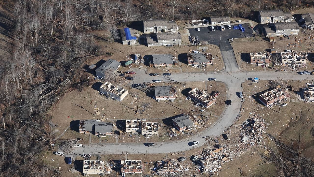
US tornadoes: Aerial pictures show scale of devastationThe death toll from the tornado swarm has been estimated to be at least 90 people, with deaths in Arkansas, Illinois, Missouri and Tennessee. The greatest loss of life was in Kentucky, where Gov. Andy Beshear said in a news briefing that at least four counties had tolls in the double digits. A dozen people were killed in Warren County, several of them children; in Muhlenberg County, there were 11 victims, all in the tiny town of Bremen. One was 4 months old.Here we take a look at the aerial pictures that show the scale and devastation of tornado-hit Mayfield, in Kentucky.
Last Updated IST

US tornadoes: Aerial pictures show scale of devastation Credit: AFP Photo

Several people died in Kentucky from devastating tornadoes that left a trail of destruction across the US state. Credit: AFP Photo
Days after the tornadoes hit, officials are still struggling to establish the toll as emergency responders pick through the rubble of thousands of damaged or destroyed homes and buildings. Credit: AFP Photo
Hundreds of people in Kentucky remain unaccounted for, and
Thousands of people have been left homeless by what Beshear has described as the state's worst storm on record. Credit: AFP Photo
Communities were also digging out in five other states where tornadoes touched down Friday night into Saturday, in what US President Joe Biden described as
The tornadoes killed at least 14 people outside of Kentucky, including six in an Amazon warehouse in the southern Illinois city of Edwardsville, where they were on the night shift processing orders ahead of Christmas. Credit: AFP Photo
With an immense recovery effort looming, immediate concerns for residents' safety and well-being were front and center as cold weather began to bite in towns that resembled war zones. Credit: AFP Photo
A nondenominational church in Mayfield was handing out food and clothing to storm survivors while also providing space for the county coroner to do his work, said pastor Stephen Boyken of His House Ministries. Credit: AFP Photo
Storm trackers said it had lofted debris 30,000 feet (9,100 meters) into the air, and the Mayfield twister appeared to have broken an almost century-old record, tracking on the ground more than 200 miles (320 kilometers). Credit: AFP Photo
Mayfield, a town of about 10,000 near the westernmost tip of Kentucky, was perhaps the hardest-hit community: city blocks were leveled, historic homes and buildings were beaten down to their slabs, tree trunks had been stripped of their branches and cars lay overturned in fields. Credit: AFP Photo