Developed as a planned suburb after the plague of 1898, upper Malleswaram is one of the oldest localities in Bengaluru. The city’s rulebook for development, Revised Master Plan 2015, classifies it as a mixture of residential and mixed residential zones. Development has taken its toll on the quaint neighbourhood.
Most of the roads have been commercialised here, without breaking rules. The toll it took on the infrastructure, however, has the residents worried.
“Senior citizens whose children move abroad would sell off their properties, which would later be converted to commercialised property,” says Shyamala Murthy, a member of Malleswaram Swabhimana Initiative (MSI).
An MSI team surveyed the area, assessed the damage done and collected signatures for a campaign against it. The petition with over 1,800 signatures was submitted to the chief minister, MLA of the area, who’s-who in the BBMP and all political party leaders, who assured to put a halt to the rampant commercialisation.
However, the residents are still awaiting the action. “We don’t want this area to become like Indiranagar,” says Shyamala.
New area, old problems
In contrast to Malleswaram, Kasturinagar is a new area. Ten years ago, this was a quiet neighbourhood— so quiet that people left areas such as Indiranagar to settle down here.
Now, with a Metro station coming up closeby, the area buzzes with commercial activity. The commercial buildings on main roads with no parking facility make vehicles spill over onto the residential areas.
“During daytime, there are many cars parked everywhere in the area, causing two-lane roads to turn into single-lane ones,” explains Praneeth, a resident of the area.
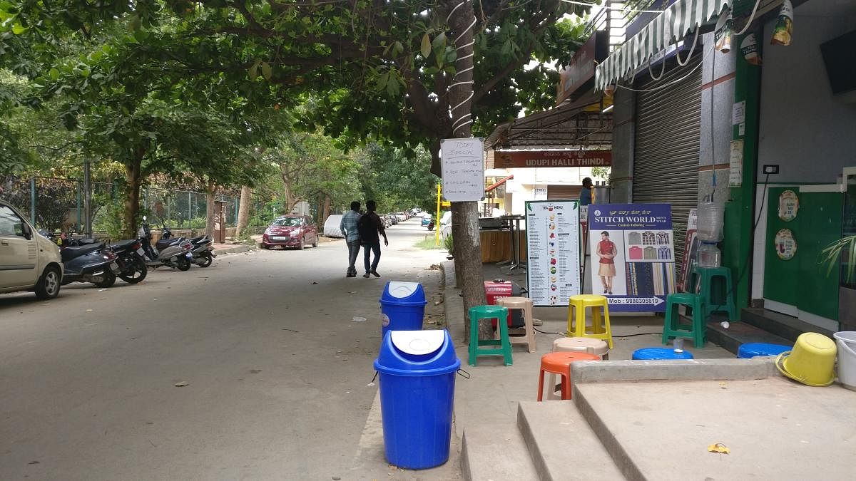
Footpaths on the side roads are occupied by vendors, the spillover goods from shops, furniture of neighbourhood eateries and parked vehicles. A shopkeeper, who preferred anonymity, explained about the citizens’ efforts to evacuate footpath vendors and the political nexus that scuttled it.
Some battles won
In Whitefield, Inner and Outer Circles are designated residential areas. Sometime ago, a few vigilant residents went to court against a school coming up in a narrow road. The case went in their favour and the school moved to the main road.
The owner of another business moved out without fuss when the residents alerted her about the master plan’s zoning rules. There are a few businesses still operating. The BBMP has turned a blind eye, and residents are not worried.
“If they are disturbed, the residents living next to those establishments should take it up with authorities,” says Deepa, an old-time resident of Whitefield, adding that there is a limit to individual activism in fighting such battles.
Spiral of court cases
Koramangala and HSR Layout have aware citizens who have fought hard to halt problematic projects. However, the battle seems to be uphill for them, when it comes to commercialisation.
In 2015, residents of Koramangala sued BBMP for issuing a licence to an eatery on 8th Main Road of 3rd block. This was granted licence despite a Karnataka High Court’s order that banned new licences to commercial establishments in residential areas, December 2012 onwards.
That was not all. The owner of the site had also violated the rules that say only 20% of the built-up area is allowed to operate commercially in R2 category according to the master plan. Four years later, the case is still in court, while the eatery has been operating with an expired licence. Meanwhile, the proposed new master plan identifies the road as residential.
In HSR layout, a pub ran without trade licence and no-objection certificate from neighbours. When residents went to the Lokayukta, the latter directed that the pub be closed. The operations stopped for 10-15 days.
But the rot ran deeper in the system. B N R Reddy, chairman of the Federation of RWAs, HSR Layout, says that the powerful personalities involved managed to reopen the pub.
The case will be heard again in the Lokayukta court only in October, while the status-quo will remain unaffected.
The curious case of complete residential areas
The comparison of existing and proposed zoning for Whitefield throws out an interesting observation. The proposed land use map for Revised Master Plan 2030 for the area surrounding Whitefield’s concentric circles shows a much larger area earlier categorised as industrial, turning Residential.
With metro lines traversing in the area, the area is likely to be more commercialised, but the residential categorisation defies the logic. Also, how the BBMP can practically roll back the commercialisation that has already taken place here is anyone’s guess. Not just Whitefield, but many other neighbourhoods have seen this kind of conversion in the master plan.