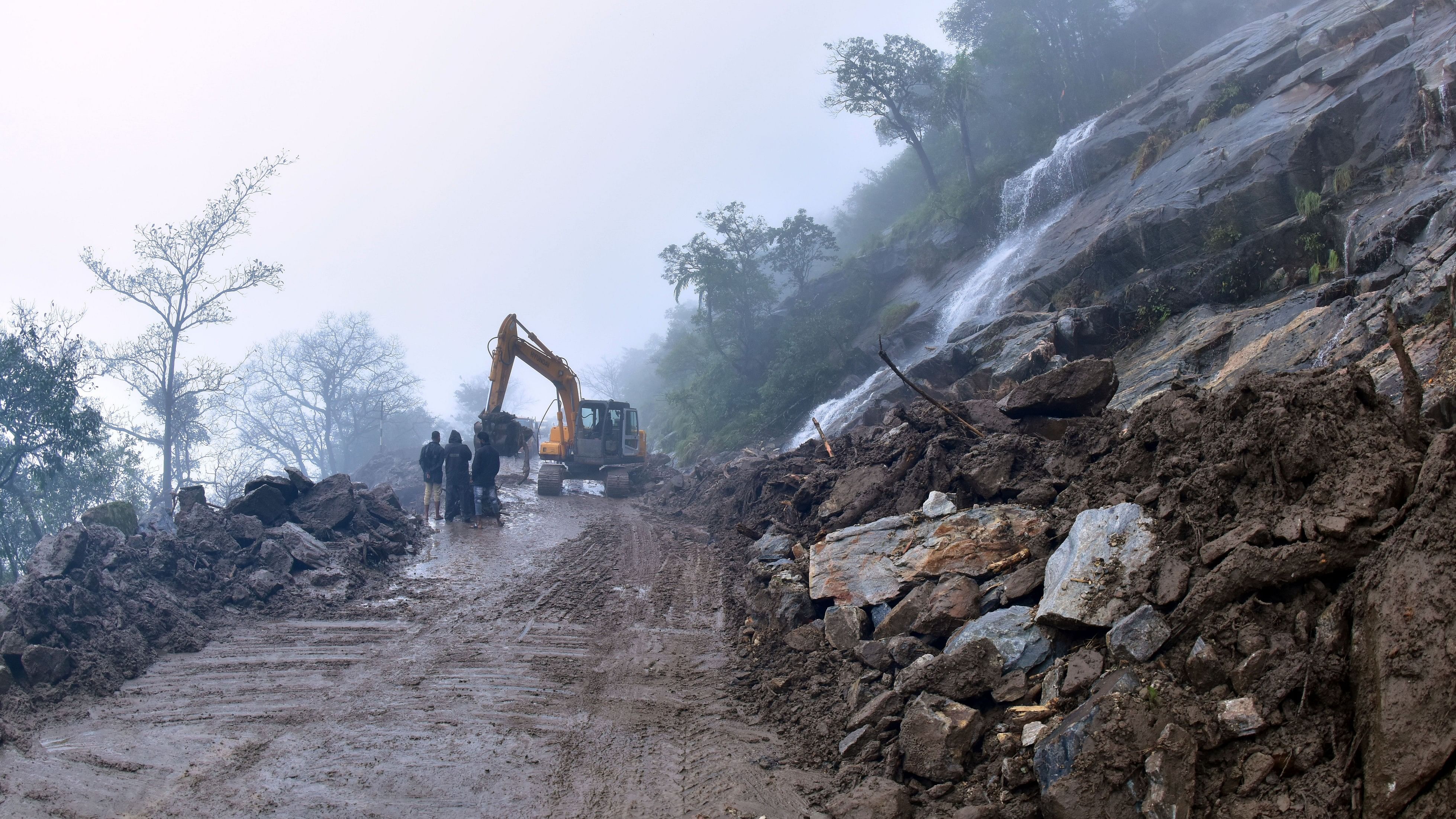
Landslides are more frequent in areas where hills have been cut for road construction, according to the report.
Credit: DH FILE PHOTO
Chikkamagaluru: The Geological Survey of India (GSI) has identified three areas in the district prone to landslides, with Mullayyanagiri, Charmadi Ghat and Bababudangiri road having the highest risk spots, according to a report.
A GSI team, which recently visited the district, conducted a study and submitted a report on the bedrock structure, topsoil, slope shape, vegetation cover, rainfall intensity, wind speed, groundwater and surface water flow and land use patterns.
According to the National Landslide Susceptibility Mapping (NLSM), 4.6% of the district is categorised as high-risk, 20.92% as medium-risk and 74.47% as low-risk areas for landslides. The report indicates that there are high and medium-risk areas along Mullayyanagiri, Bababudangiri Road and Charmadi Ghat sections. Landslides have increased due to road construction on steep slopes and heightened human activities in forests.
National Highway 73 and local roads are more prone to landslides. The GSI noted that deforestation, road and house construction by cutting and clearing hills have been the primary causes of landslides.
The team found that excessive rainfall, lack of groundwater pressure management and construction activities by cutting into hills are contributing factors to landslides.
They are more frequent in areas where hills have been cut for road construction. The report emphasises on the need to stabilise and reinforce slopes.
It suggests building gabion walls along the sides of roads, especially in areas with weakened slopes. Concrete retaining walls should have weep holes to allow water to pass through, the report says. Drainage systems should be constructed on roadsides to prevent water from flowing on the road. Comprehensive drainage systems should be built to manage surface and subsurface water flow.
Proper maintenance is necessary in landslide-prone areas to control soil erosion. Forest protection on slopes is recommended with a focus on planting deep-rooted species, the report recommends.
The report emphasises on continuous monitoring of hills susceptible to landslides, and if risks are detected, precautionary measures should be taken immediately. The GSI, which has identified over 25 landslide-prone areas in the district, has recommended relocating residents from five locations. In Koppa taluk, residents live in areas susceptible to landslides such as Guddethota, Basarikatte, Keradande in Sringeri taluk, Somankatte near Horanadu and Channahadlu.It has suggested that relocating families before the rainy season would be appropriate. It has recommended immediate relocation of residents near the steep hillock at Guddethota.